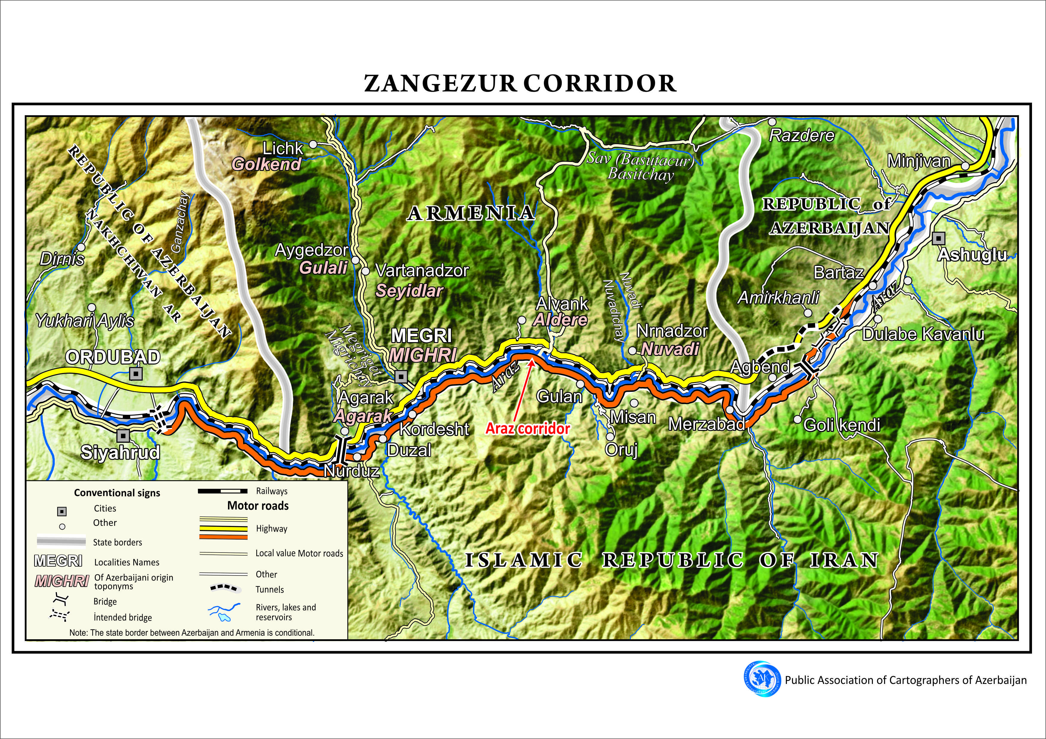


"The "Azerbaijan Cartographers" Public Union has prepared a map of the Zangezur corridor. The base of the map is based on high-quality space images," the chairman of the "Azerbaijan Cartographers" Public Union, Mugabil Bayramov, said, APA reports.
He said that the map shows relevant parts of Azerbaijan, Armenia, and Iran - settlements, roads, rivers, and mountains. The map also shows the Araz corridor.
The cartographic work is in Azerbaijani and English.