


According to him, the potential and actual erosion risk maps, which are prepared through GIS technologies, are considered initially for Upper Shirvan area – Aghsu, Ismayilli, Shamakhi regions and one part of Gobustan region.
Such maps are being prepared now for regions entering Guba-Khachmaz area. Then the erosion risk map will be compiled for entire country area.
3743,5 ha of Azerbaijani area i.e 43,3% were subjected to erosion. The strong erosion is observed in 1336,7 ha or 15,5% of it.
Social
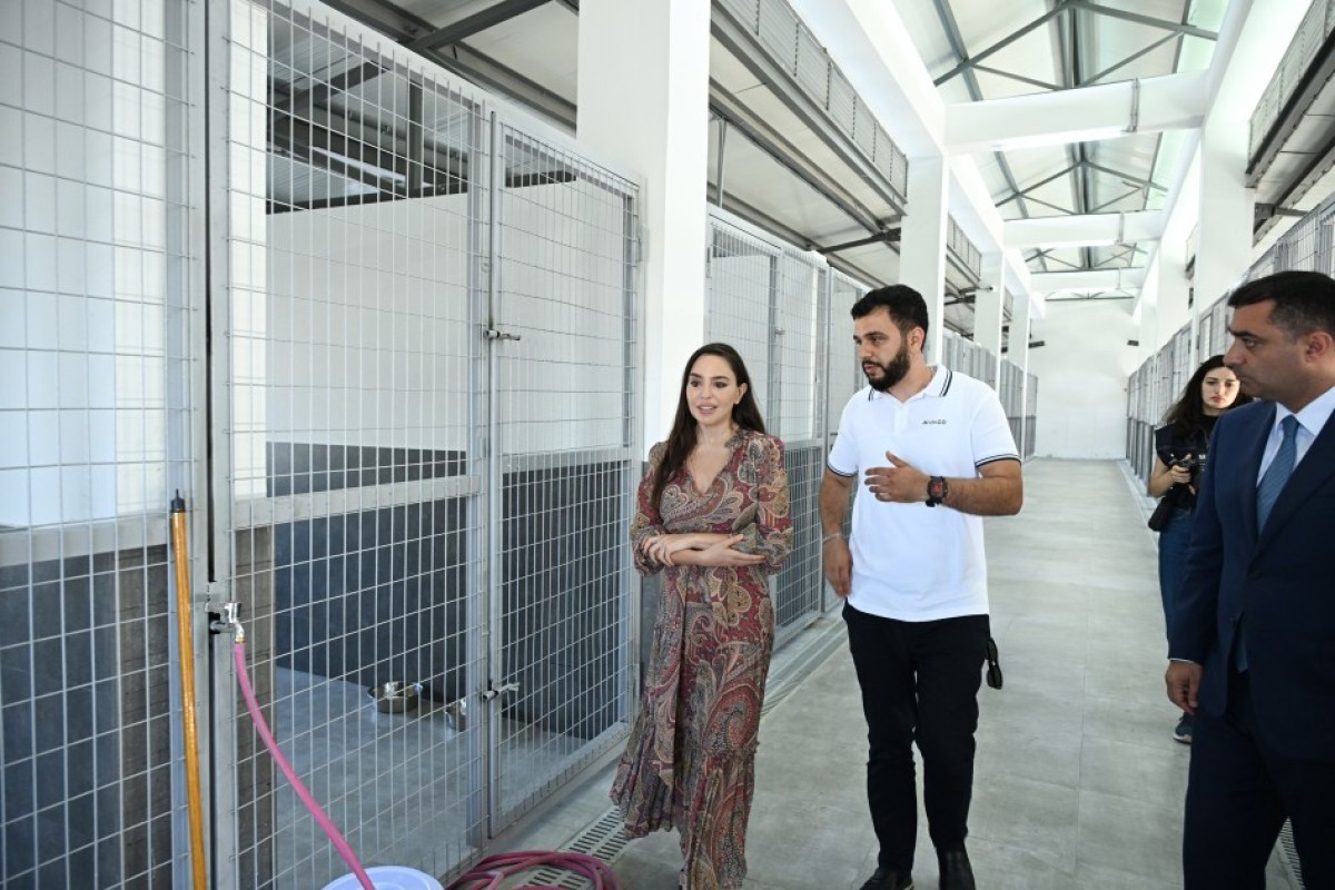
Leyla Aliyeva attends opening of regional branch of Stray Animal Care Center in Yevlakh - PHOTO
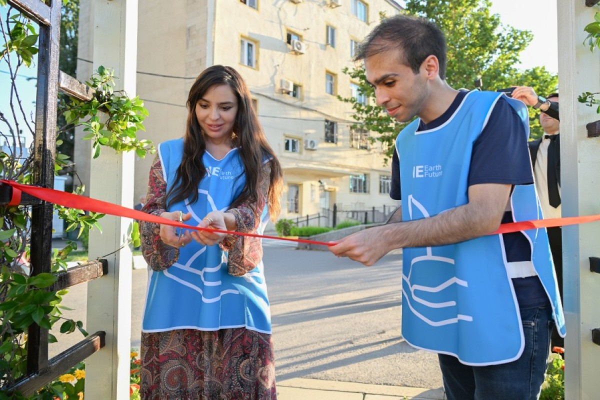
Modernized neighborhood in Yevlakh inaugurated with participation of Leyla Aliyeva - PHOTO
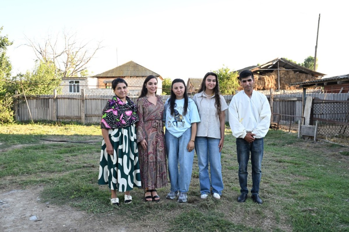
Leyla Aliyeva meets “Young Beekeeper” project participant in Yevlakh - PHOTO
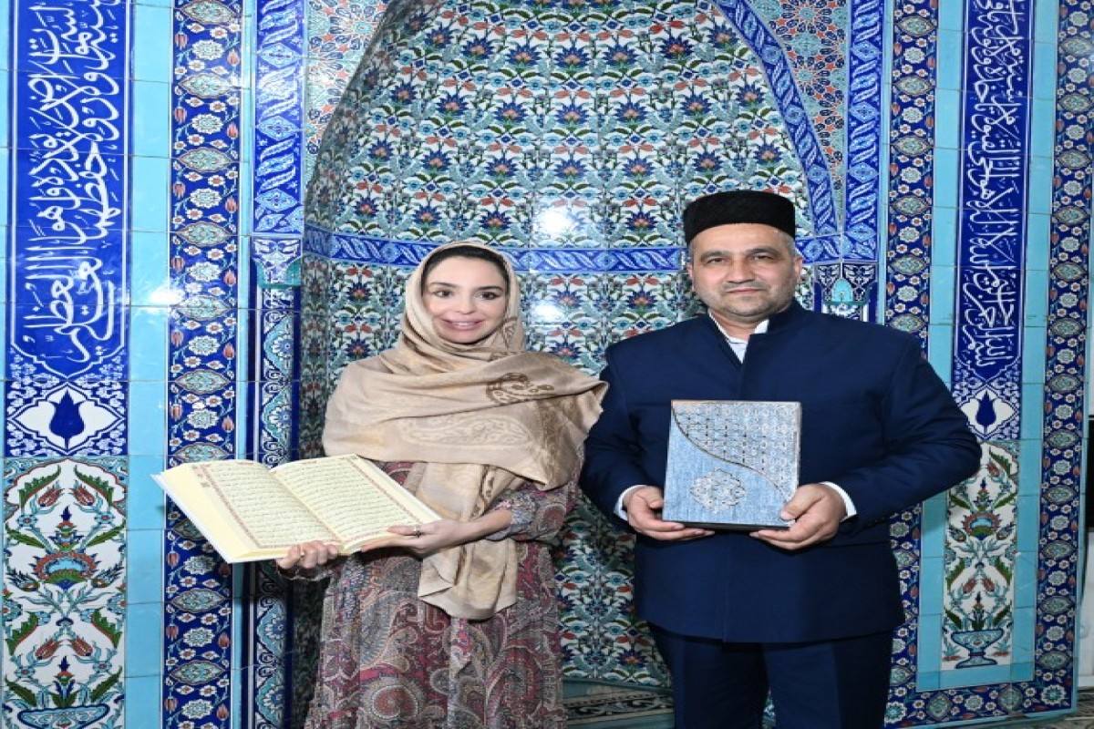
Leyla Aliyeva visits Juma Mosque in Yevlakh
NEWS FEED
Greek ruling party calls for protests after firebomb kills candidate's mother
Armenia parliament speaker Alen Simonyan to not take mandate, not be in new legislature
Pashinyan: Yerevan will continue dialogue with Moscow and its course toward EU integration
Türkiye presents Turkic World Civil Society Support System project - PHOTO
Poland detains two men suspected of spying for Belarus
Leyla Aliyeva attends opening of regional branch of Stray Animal Care Center in Yevlakh - PHOTO
Kremlin: Gerasimov reports results of massive strikes on military targets in Kyiv to Putin
Death toll from Russia's attack on Kyiv rises to 17 - PHOTO - UPDATED-3
Tajik man accused of spying on Israel for Iran
ADB: Expanding electric transport could bring Azerbaijan $18 mln annually
Russian forces strike plant producing Flamingo missile systems in Kyiv
Modernized neighborhood in Yevlakh inaugurated with participation of Leyla Aliyeva - PHOTO
Leyla Aliyeva meets “Young Beekeeper” project participant in Yevlakh - PHOTO
EU chief on Armenia's normalization with Azerbaijan and Türkiye: The reward will be very great
Leyla Aliyeva visits Juma Mosque in Yevlakh
Leyla Aliyeva attends opening of new school building in Yevlakh
Azerbaijan presents report on Armed Forces' peacekeeping operations - PHOTO
BSTDB financing for SOCAR Trading reaches $70 million
Security Council: Azerbaijan's future role in peacekeeping missions should be planned now
Ursula von der Leyen: EU to provide an additional €18 million in aid to Armenia
SOCAR delivers Uzbek-produced naphtha to international markets via the Black Sea
Russian Embassy in Sweden targeted in drone attack
AIR Center: Azerbaijan's middle power status is the result of a long-term process
Ukraine strikes one of Russia's largest oil refineries and key bridge
Kyiv declares mourning for victims of Russian attack
BSTDB has financed over €9 billion in projects since its establishment – Vice President
Armenian PM Nikol Pashinyan meets European Commission President Ursula von der Leyen
Azerbaijan launches Online Inquiry Center for missing persons
BSTDB President: Our more than 20-year partnership with Azerbaijan is built on mutual trust
BSTDB ready to expand investments and business cooperation with Azerbaijan – President
Finance Minister: The Middle Corridor further strengthens Azerbaijan's strategic position
BSTDB Business Forum held as part of the Annual Meeting - PHOTO
Finance Minister: Azerbaijan's economy is undergoing a major transformation
President Ilham Aliyev receives Turkish Justice Minister Akın Gürlek - PHOTO
Azerbaijani oil sold for $72
Gold futures decline, silver edges up on COMEX
Two killed, six injured in Ukrainian drone strikes on two Russian regions
Netanyahu says Israel should gradually end dependence on US financial aid
Oil prices are falling again on global markets
Construction of the Asgaran–Khojaly–Khankendi highway reaches 86% completion
European Commission President Ursula von der Leyen concludes working visit to Azerbaijan
UN's new Resident Coordinator in Azerbaijan assumes office
US advances to Round of 16 at 2026 World Cup after 2-0 win over Bosnia and Herzegovina
Brent falls below $71 per barrel, first time since February 27
Belgium beat Senegal 3-2 to reach World Cup last 16
Trump believes Cuba is "moving toward" the United States
Qatari diplomat notes progress at US-Iranian indirect talks in Doha
Audio
Rutte says White House is disappointed with European allies over Iran
President Ilham Aliyev and President of the European Commission delivered press statements - UPDATED-1
President Ilham Aliyev held expanded meeting with President of the European Commission-UPDATED