


Baku. Kamala Guliyeva – APA. Though mass media report about the fracture in the layer of the earth from Salyan region towards Hajigabul region of Azerbaijan, these reports are restricted to news. It seems that nobody cares for the real problem created by the fracture. The fact is that the layer of the earth fractures in a large territory of Azerbaijan, this fracture awakes earthquakes and mud volcanoes…
The visible side of the problem
The first reports about the problem spread on April 1. At the event held by the Geology Institute of Azerbaijan National Academy of Sciences, chief of seismology and geodynamics department Fakhraddin Gadirov said that the Ministry of Emergency Situations informed the institute about the process that began early in March. The scientist said:
“The eastern part of that territory fell by 5-10 cm. Small mud volcanoes erupted in some places. The most important is that they caused 3.5, 3.6 and 3.2 magnitude earthquakes in Hajigabul. The process is continuing. If we increase the number of the measurements, we can say how the process is developing. All theoretical studies show that this landslide can move towards Absheron. This is the main threat.â€
Gadirov also explained the cause of the landslide.
“Horizontal process is going on at 15 km depth of the crust of earth under the influence of the Arabian platform. The directions of these horizontal processes change beginning from Salyan. Move towards east dominates in Salyan, Khidirli and Baku, move towards north and west dominates in the others. It seems as if western part from Slayan to Shamakhy is trying to move contraclockwise, the other side clockwise. There is much difference of speed here. This difference of speed is among Khidirli, Shikhlar, Baku and Gurgan. From Khidirli to Gurgan these speeds change on the east component from 6 mm to 0. This is very dangerous. It seems as if you pull something from one side, and keep from the other. Fracture occurs at that time. This fracture is inside the platform. Maybe it is old, but has become active now. It causes fear. There are old earthquake focuses and fractures in Absheron. They can also become active. A fracture happened in that territory during the earthquake in Zabrat in 1842. It can also become active. This process should be studied exactly. The relevant state agencies have been appealed for. There are fractures inside the houses in that territory,†he said.
The intensity of quakes in the above-mentioned territory has increased. 3.50-magnitude and 3-magnitute quakes hit Hajigabul on March 4-5 this year. Shikhzeyirli and Erebshahverdi mud volcanoes erupted in Gobustan on March 13. The next day four quakes happened in Shirvan. Four quakes hit Shirvan on July 12.
The geological processes caused serious concern in the region
Director of Geoecological Monitoring Center of the Ministry of Ecology and Natural Resources Ali Aliyev told APA that geological processes that damaged a number of houses in Abad and Khalaj villages of Salyan region this March caused serious concern in the region. The Ministry of Ecology and Natural Resources and the Ministry of Emergency Situations set up an expert group to study the problem. The group made the initial visual analysis of the territory in connection with the tectonic activity observed in Abad and Khalaj villages of Salyan region, Shikhzeyirli and Erebshahverdi mud volcanoes, assessed the current state of the geological-tectonic and seismotectonic processes in the region citing to the seismogeodynamic monitoring, seismostatistic, fund and archival data.
“The initial studies showed that the Abad-Khalaj crack system, which falls on the middle part of the deep fracture of Gizilaghaj-Shamakhy, has certain unidirectionality with it and inclined to the weak right slip. The new fracture network observed from the west of the State Traffic Patrol in Salyan region intersects the Salyan-Shirvan highway in the 6th km and lasts towards north-east. The studies done by the National Geological Exploration Service show that the width of the crack system is increasing. The width of the failed rocks in 5-meters deep bore pit makes up 4 meters. This coincides with the depth of the fractured zone discovered in the territory of Gizilaghaj-Shamakhy earlier. The geological changes are local, not regional,†he said.
Azerbaijan at the beginning of active geodynamic phase…
Ali Aliyev said the new crack systems accompanied by local quakes show that the activeness of geological processes enters a new, more active phase.
“Some earthquake sources and mud volcanoes near those territories were seriously analyzed by the experts. Geological-tectonic processes recorded in Abad and Khalaj villages in 2011 can be connected with geodynamic activity in the seismoactive zone of the Caucasus, Shamakhy-Ismayilli. Beginning from February weak seismic processes in the eastern part of the country shows the start of the new geodynamic phase. The formation of the new active and contrast geodynamic condition can be regarded as existence of abnormal seismic processes in the region. On the other side, the solar cycle and endogenous regime contrasts and changes stated in 2010 serve for increase of intensity of anomalous geotectonic processes on earth crust. The earthquakes in HAITI, China, New Zealand, Indonesia, Thailand, Chile, Japan and Philippines, which started from January 2010, confirmed again that the intensity of geodynamical processes in entire planet is continuing on increased lineâ€.
The cracks can cause serious consequences for constructions and equipments
Aliyev said that the territory of Abad and Khalaj villages are tectonically related to the Ashagi Kur depression. The results of the last geophysical researches, conducted here, showed that Ashagi Kur lowland, which was cut with Ismayilli-Gizilaghaj and Shamakhi-Gizilaghaj abyssal fractures, has a sediment layer of big thickness (18-21km). The declension to the east is observed on the line of rent of both abyssal fractures. The south end of tectonic dislocations (Padar-Sangachal) is relatively calm from geodynamical point of view. Only their north ends are seismically active zones. Seismostatistic analysis showed that tectonic cracks, recorded in Ashagi Kur lowland, must be considered finished and there is no supposition of occurrence of strong and catastrophic earthquakes in that part. Only in certain parts of the main line of rent the formation of local cracks may occur. The crack systems, observed n Khalaj and Abad villages – are cracks formed along the zone of regional tectonic dislocation in submeridional direction.
These cracks can cause serious consequences for constructions and equipments. However, they can not lead to large-scale disasters because of geotectonic parameters and characteristics.
Seismologist denies that the formed crack can cause earthquakes
Director of Seismological and Geodynamics department of ANAS Republic Seismological Service Center Tahir Mammadli told APA that the processes occurring in the territory from Salyan to Hajigabul, have no relation with the earthquake: “It is wrong to relate the formed crack with the earthquake. One needs to prove it. The earthquake forms crack. The crack doesn’t form earthquake. Secondly, the earthquakes occurred there can not form the cracks in the layer of earth. Earthquakes occur at depths of several kilometers. The depth of the weakest earthquake is 3-4 km. the earthquake strength must be just over in order to form crack on the top of the ground.
Earth fracture accelerates in Azerbaijan – RESEARCH - PHOTOSESSION

Social
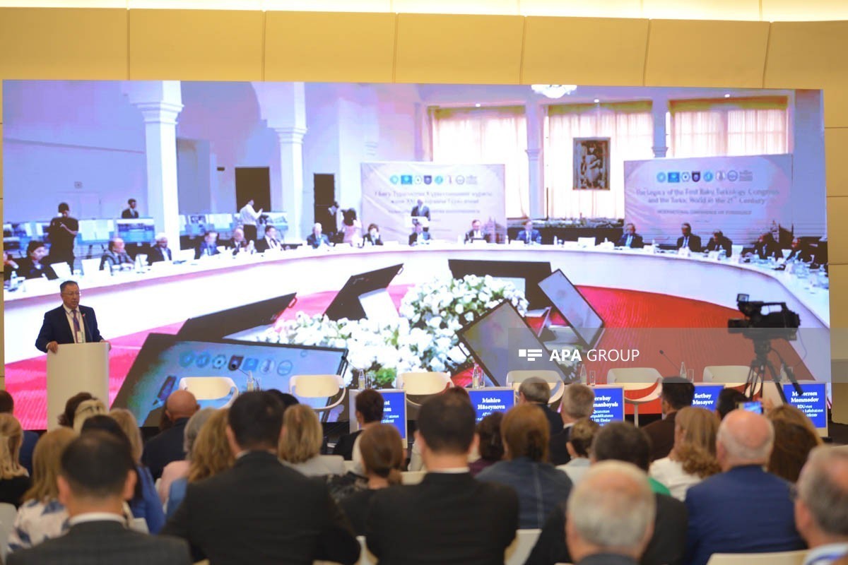
International conference on teaching Turkic languages, literature and history in the context of modern challenges held - PHOTO
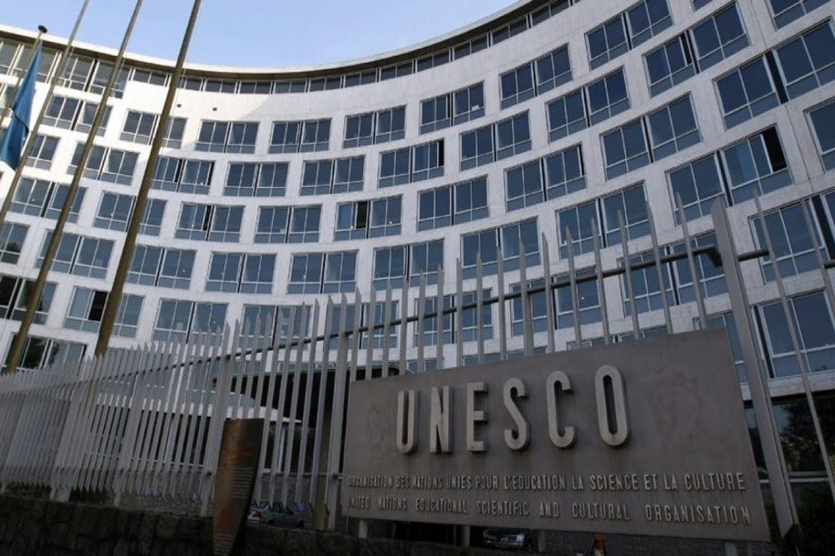
100th anniversary of the First Turkological Congress to be marked at UNESCO
Special conference to be held in Khankendi during Turkic World Week

Leyla Aliyeva and Alena Aliyeva attend Charity Festival
NEWS FEED
Explosion rocks Monaco, at least three wounded
US Secretary of State, German FM discuss Middle East, Ukraine
MLS club Chicago Fire announced the transfer of footballer Lewandowski
Upcoming US-Iranian consultations may be important — Trump
Audio
Brazil survives Japan scare to book round of 16 spot
Venezuela's earthquake death toll climbs to 1,719
Audio
Iran's Foreign Ministry: A delegation from republic will visit Qatar
Israel's Defense Minister says renewed war with Iran is possible
Audio
UN Secretary-General pointed out that terrorists are adapting to new technologies
First meeting of the Digital Development Council held under the chairmanship of First Vice President Mehriban Aliyeva - PHOTO-UPDATED
National Data Pool established in Azerbaijan
Oman rejects Iran-backed tolls on ships crossing Strait of Hormuz
Mehriban Aliyeva: Artificial intelligence is playing an increasingly central role in ensuring states' security
Kazakhstan and Georgia sign strategic partnership agreement
Ukraine says it struck three bridges, ammunition depot and command posts
New round of Israel-Lebanon peace talks to be held on June 30 with US mediation
Moscow reiterates objection to Armenia’s EU course while maintaining EAEU benefits
Turkic World Week discusses dynamics of Turkic languages' development
International conference on teaching Turkic languages, literature and history in the context of modern challenges held - PHOTO
Galuzin: TRIPP's prospects are uncertain
Dubai welcomes first flight from Tehran after Middle East conflict pauses
White House: US is fulfilling its obligations under the ceasefire agreement with Iran
Official Moscow: Armenia is not considering closing Russian military base in Gyumri
Witkoff, Kushner to attend meeting with Iran, White House says
Russian deputy FM: Moscow and Baku have resolved all issues related to AZAL plane crash
Azerbaijani public rejects artificial campaign defending war criminals
Russia's ballistic missile strike on Dnipro kills 5, injures 29 - UPDATED
Five killed in shooting in northern Germany
Plenary session held as part of Turkic World Week
Trump says oil prices are falling
Trump: 'Tehran requested meeting, it will take place tomorrow in Doha'
EU countries inject 22 bcm of gas into underground storage for winter season
100th anniversary of the First Turkological Congress to be marked at UNESCO
Participants of First Turkological Congress centenary event visit Alley of Honor
Azerbaijan approves visa-free agreement with Ecuador for holders of diplomatic and official passports
Peskov: Our position on resolving the Ukraine conflict remains unchanged
Iran denies that technical meeting with US expected in coming days
Belarus to respond with full military potential if Ukraine crosses the border, deputy foreign minister says
Russia says it intercepted more than 400 Ukrainian drones
FSB arrests man planning to set fire to a synagogue — Russian media
“Aibyn-2026” International Military-Patriotic Youth Gathering ends
Iran president says country will receive $6bn of frozen funds held in Qatar
Special conference to be held in Khankendi during Turkic World Week
Turkic World Week dedicated to the 100th anniversary of the First Turkology Congress opens in Baku - UPDATED - PHOTO
OTS Secretary General: 100th anniversary of the First Turkological Congress is of historical significance for our peoples
Secretary General: Meeting held in Baku marks the beginning of a new stage in the history of the Turkic world
Aghdam and Shusha to host Turkic World Week events
Mirziyoyev: Turkology faces new tasks in the modern era
IDF: In response to Hezbollah violations, we struck 3 headquarters in southern Lebanon
Iran, Oman hold first meeting of joint committee on Hormuz, Iranian deputy FM says