


Chief engineer of the Complex Hydrogeology and Engineering Geology Expedition of the Ministry of Ecology and Natural Resources Shaig Niftiyev told APA that Masazir settlement is situated in the Sumgayit-Fatmayi tectonic field in north-west of composite syncline Eastern Absheron and there are old New Caspian clayey layers and grounds of Balakhani layer in the geological scrap of the territory. Ground waters, as well as technogenic, sewage and melioration waters collected in the territory in 3-10 m depth, said Niftiyev.
He said that the width of landslide area identified in 2011 at 100-110 m from west bank of “Gir†lake varies from 30 to 35m, length varies from 80 to 100m: “The arc of the landslide is 1.0-1.2. Loamy deposits, seasonal precipitations, wastewaters lead to the development of cracks, subsidence, caving and fluidityâ€. According to chief engineer, the width of landslide area is 40-42m, length – 85-110m, height of landslide arc – 3.5-4.0m.
Results of engineering-geological researches in Masazir landslide area made public

Social

Azerbaijan moves to tighten penalties for repeated online gambling

Azerbaijan identifies new grounds for temporary restriction of internet information resources
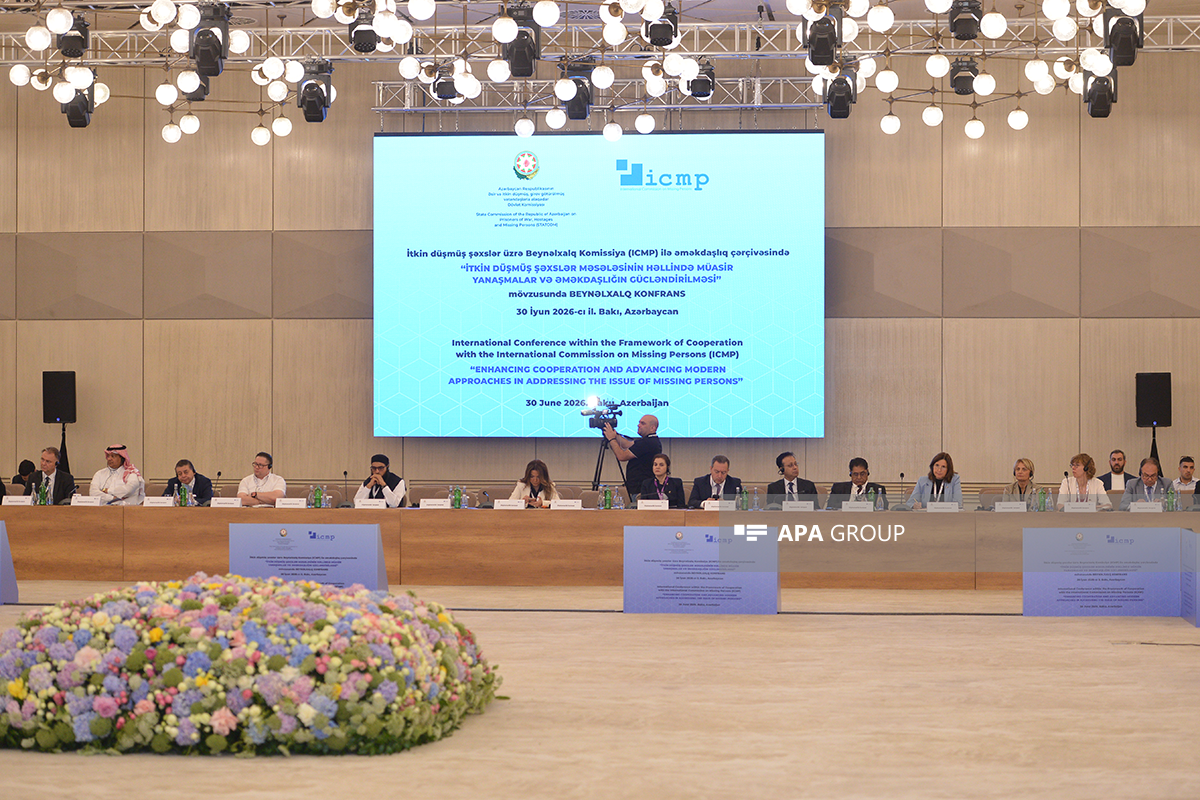
International conference on missing persons held in Baku - PHOTO - UPDATED

International congress held in Baku as part of Turkic World Week
NEWS FEED
Ukraine and Sweden sign historic agreement on Gripen fighter jets
Vance: China is ahead of the US in AI development thanks to the construction of energy facilities
Strait of Hormuz to be free of tolls, Vance says
Audio
Iran exported 50m barrels since US blockade lifted
White House puts cost of Iran war at about $30 billion
Audio
Norway to face Brazil after defeating Ivory Coast 2-1
Trump calls birthright citizenship ruling "massive" win for China
Audio
Oman proposes Strait of Hormuz fee plan to US
Russia strikes energy facilities in Zaporizhzhia
Appeal hearing on complaints filed by Armenian citizens continues
14 students killed as tuition academy roof collapses in Pakistan's Lahore
Lithuania's parliament approves Sinkevičius as prime minister
Azerbaijan FM meets with ICMP Director General Kathryne Bomberger
Israel's so-called "Armenian genocide" decision: Azerbaijan once again became the first to stand by Türkiye - ANALYSIS
President Ilham Aliyev offers condolences to Delcy Rodríguez over earthquake in Venezuela
First meeting of heads of religious affairs institutions of OTS member states held in Shusha - PHOTO - UPDATED
Heads of OTS religious affairs institutions tour Shusha - PHOTO
Iran: Speaker Ghalibaf's visit to Baku was successful
Milli Majlis Support Group calls for granting Corsican people the broadest autonomy
Iran FM: No separate meeting with the US planned in Doha, discussions will focus on memorandum
Final communiqué signed following First Meeting of OTS religious affairs chiefs in Shusha - PHOTO
Rutte: Claims that the US is distancing itself from NATO are not true
Samvel Karapetyan claims Armenian opposition has "secret plan" to remove Pashinyan from power
Germany and the Netherlands take command on NATO's eastern flank
State Commission announces burial ceremonies for six more missing martyrs
US envoy Witkoff and Kushner will be in Qatar, but no meeting with Iran, Qatari official says
Morgan Stanley cuts Brent price view as Hormuz flows recover, flags 2027 surplus
EU allocates €3.9 billion for drones for Ukraine under €90 billion loan package
Fuel sales restricted in Russia's Altai Republic from July 1 to September 1
Kremlin to keep names of fuel supplier countries confidential
Armenian PM to attend Ali Khamenei's funeral ceremony in Tehran
Zelenskyy: Ukrainian long-range strike hits Russia's Dubna Space Communications Center again
Uzbek committee chairman: Strengthening cooperation in religion and education across the Turkic world is essential
ICMP chief: More mass and clandestine graves remain to be discovered - INTERVIEW
2 members of Iran's IRGC killed in shooting: Reports
Azerbaijani and Kazakh foreign ministers hold phone call
Türkiye strengthens air defense capabilities, considers acquiring SAMP/T and Patriot systems
Azerbaijan moves to tighten penalties for repeated online gambling
Azerbaijan identifies new grounds for temporary restriction of internet information resources
International conference on missing persons held in Baku - PHOTO - UPDATED
Talantbek Tashybekov: Strengthening coordination on religious policy within the OTS is essential
International congress held in Baku as part of Turkic World Week
Customs duty exemption to be introduced for exports of goods produced in the Alat Free Economic Zone
State Commission: Azerbaijan to acquire specialized underground radar systems for missing persons searches
Safi Arpaguş: Turkic states should strengthen coordination in religious affairs
OTS Secretary General: New cooperation format on religious affairs will contribute to social cohesion and stability
Ramin Mammadov: Foundation laid in Shusha for OTS' first multilateral platform in the religious sphere
Georgian speaker: Azerbaijan-Armenia peace process creates cooperation opportunities for the region
Nearly 100 bcm of Azerbaijani gas transported via TANAP to date
Uzbekistan's Culture Minister: Unity is essential in the face of threats